DFW Now Sprawls Across 12 Congressional Districts Under Newly Approved Texas Maps
Share
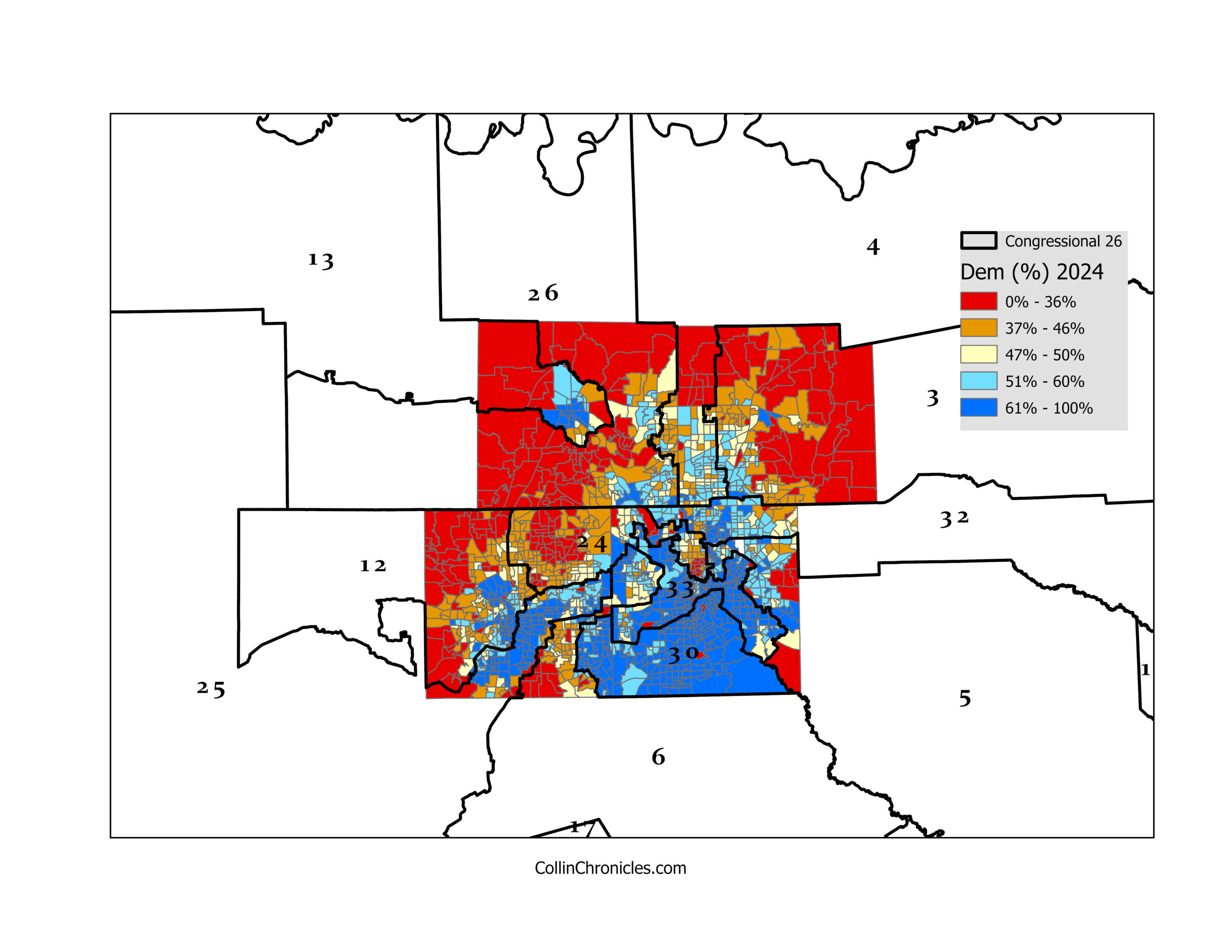
The Dallas–Fort Worth region now finds itself divided among 12 different congressional districts, a significant jump that underscores both the area’s explosive growth and the ongoing political battles shaping Texas. The new maps, recently approved by state lawmakers, carve the Metroplex into a patchwork of districts stretching from dense urban centers to far-flung suburbs and rural counties.
Critics argue that the configuration reflects modern gerrymandering at its most intricate, with boundaries zig-zagging around diverse communities and slicing through cities such as Dallas, Fort Worth, Arlington, Plano, and Frisco. Voting-rights advocates say the maps dilute cohesive urban voting blocs and weaken representation for rapidly growing minority populations across North Texas. Supporters, however, contend that the districts balance population shifts and maintain continuity within long-standing political regions.
The DFW area—home to over 8 million residents, massive economic output, and some of the fastest-changing demographics in the nation—now plays an outsized role in statewide and national elections. With so many congressional seats touching the Metroplex, every election cycle will draw heightened attention, increased campaign spending, and intense competition. As Texas continues to evolve, the political future of the state may hinge significantly on how DFW’s newly divided landscape shapes voter turnout and representation in the years ahead.
